The LifeRing Command and Control system has many datalink and digital interfaces. Some of these are Command and Control interfaces to other Command and Control Systems. These Command and Control interfaces include JVMF, OTH Gold, NFFI, SARIR and Link 16. AGIS unifies systems using differing datalink standards providing Interoperability between systems interfaced to LifeRing.
LifeRing also provides datalink interfaces to sensor systems including: Federal Aviation Administration (FAA) radars, Shore based Naval radars, Ship Automatic Identification System (AIS) transponders, some ground based intrusion Seismic sensors , Gunshot detectors (Boomerang) and some classified sensors. The information from these sensor systems is processed by LifeRing and is then sent to the other interfaced Command and Control systems.
Special hardware interfaces include: Iridium handheld satellite communications, Thuraya handheld satellite communications, BGAN Satellite communications, GPS Trackers such as: NAL, Cornerturn and satellite based SPOT, Laser targeting devices such as the Vectronix PLRF 25C and radio and MANET interfaces including Harris, Motorola, Persistent Systems, Trellisware, and private cellular systems such as (Radisys, Lemko, TLC, Oceus and others).
These LifeRing datalink interfaces are separately licensed applications offered by AGIS, Inc. and are not included in the regular PC AGIS Package. Many are only available with the military LifeRing software and require Department of State ITAR approval.
AIS
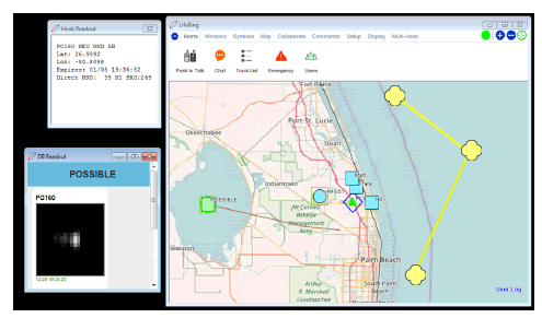
LifeRing permits users to track vessels that are equipped with AIS. AIS provides a ship’s MMSI number and the last time the ship’s location was refreshed. Participants can track vessel location in real time. In certain instances, AIS will have more information available such as an IMO number, vessel name, destination, etc.
The LifeRing AIS interface is available for Commercial LifeRing.
Boomerang
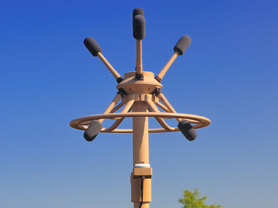
Boomerang is an acoustic system installed on military vehicles that is designed to detect relative shooter azimuth/range/elevation from incoming small arms fire. It performs passive acoustic detection and computer-based signal processing. Aural and visual alerts are used to 1) inform vehicle occupants that a bullet has passed within close proximity to the vehicle and 2) indicate the position of the shooter relative to the vehicle”s direction of travel. Boomerang operates when the vehicle is stationary or moving (no motion compensation) using a single, compact, mast-mounted array of microphones. The system is calibrated to detect infantry small arms. LifeRing processes this data and displays it and forwards it to interfacing systems.
The Boomerang interface is available for Military LifeRing. It requires a Department of State ITAR. Please contact us for more details.
Cornerturn
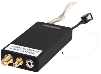
The CornerTurn tracking tag works with cellular or satellite communication reporting its location every “x” minutes. This data is received by LifeRing and the resulting tracks and displayed as part of the COP.
The Cornerturn devices and interface is only available for Military LifeRing. They Require a Department of State ITAR. Please contact us for more details.
CoT
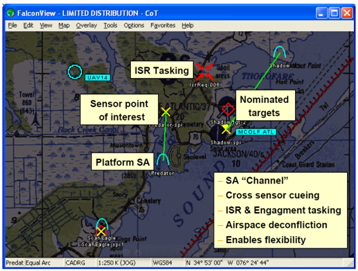
Cursor on Target (CoT) is a MITRE designed software package that provides a means to interface with over 100 different systems including ATAK.
The CoT interface is available for Military LifeRing. It requires a Department of State ITAR. Please contact us for more details.
DELTA INTERFACE
The Delta interface provides a real time COP interface to a US Partners in Peace Countries sensors and unit locations.
The Delta interface is available for Military LifeRing. It requires a Department of State ITAR. Please contact us for more details.
FAA RADAR
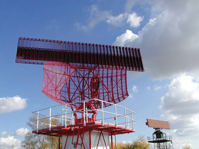
The FAA US radars primarily consist of a mixture of Long Range Air Route Surveillance Radars (ARSR) of various types, including 44 ARSR-4/FPS-130 radars to replace some of the many previous long-range radars. The ARSR-4/FPS-130 is a 3-D long range radar with an effective detection range of some 250 miles and has been fully integrated with JSS at all joint use sites.
LifeRing interfaces to these radars using the radar’s Common Digitizer -2 datalink format. The LifeRing CD-2 radar interface is available for Military LifeRing. It requires a Department of State ITAR. Please contact us for more details.
FALCONVIEW
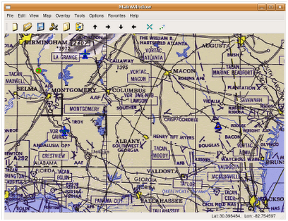
FalconView is a mapping system created by the Georgia Tech Research Institute for the Windows family of operating systems. It displays various types of maps and geographically referenced overlays. [1] Many types of maps are supported, but the primary ones of interest to most users are aeronautical charts, satellite images and elevation maps. FalconView also supports a large number of overlay types that can be displayed over any map background. The current overlay set is targeted toward military mission planning users and is oriented towards aviators and aviation support personnel.
Available for Military LifeRing
GOOGLE MAPS
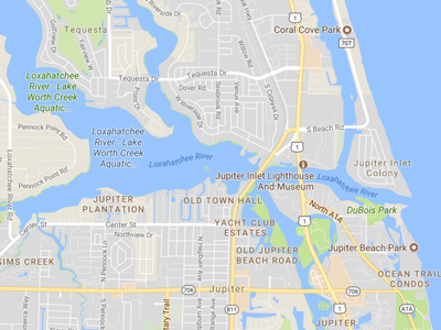
LifeRing supports a Google Maps interface which provides personnel who have not loaded LifeRing on their PC the ability to display the LifeRing data and to request amplification data on entered Markers and Tracks received from unclassified sensors.
The LifeRing Google maps interface is available for Commercial LifeRing.
IRIDIUM GO
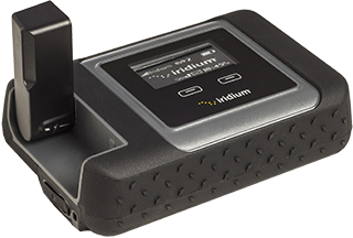
Iridium GO! enables full duplex voice and data/satellite communications between LifeRing Smartphones and PCs. The integration of LifeRing with Iridium GO! provides users a low-cost, highly portable integrated Collaboration, Coordination, Command, Common Operational Picture (COP) system with Voice Communications capability operating on an encrypted worldwide communications network. LifeRing’s Swiss Army knife approach to communications further enables integration of cellular, mesh nets, JTRS radios, Land Mobile Radios (LMR) into a low cost Worldwide on the Move network. By providing interfaces to other C4I and government systems, LifeRing / Iridium GO! enables the military, First Responders, and Government Agencies a means to communicate when cellular is down or when outside of cellular or VHF radio range.
The IridiumGO! Interface software is available for Commercial LifeRing.
JVMF
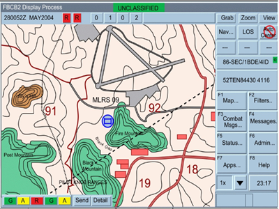
LifeRing’s ability to process Joint Variable Message Format (JVMF) messages provides a full two way interface between the Army/Marine Corps FBCB2/JCR friendly force tracking systems, the Army/Marine Corps Advanced Field Artillery Direction System (AFATDS) and many other US and Allied Military ground and aircraft systems.
The LifeRing JVMF interface is available for Military LifeRing. It requires a Department of State ITAR. Please contact us for more details.
LINK 16
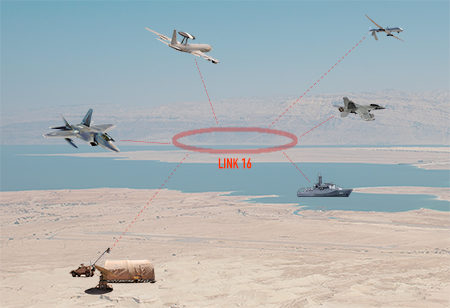
LifeRing interfaces with US and allied aircraft and ships using the Link 16 formats. By using the Joint Range Extension Applications Protocol (“JREAP”), LifeRing can receive and transmit Link 16 tactical data messages to other Link 16 equipped C4I system using various radios including even long-distance satellite links.
The LifeRing Link 16 interface is available for Military LifeRing. It requires a Department of State ITAR. Please contact us for more details.
NAL RESEARCH
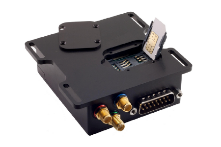
The NAL RESEARCH tracking tag works with cellular or Iridium satellite communication reporting its location every “x” minutes. This data is received by LifeRing and the resulting tracks and displayed as part of the COP and sent to interfacing systems.
The NAL interface is available for Military LifeRing. It requires a Department of State ITAR. Please contact us for more details.
GCCS
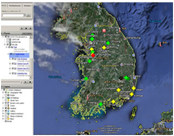
Global Command and Control System (GCCS) is the United States’ armed forces DoD joint command and control (C2) system used to provide accurate, complete, and timely information for the operational chain of command for U.S. armed forces. “GCCS” is most often used to refer to the computer system, but actually consists of hardware, software, common procedures, standards, and numerous applicactions and interfaces that make up an “operational architecture” that provides worldwide connectivity with all levels of command. GCCS incorporates systems that provide situational awareness, support for intelligence, force planning, readiness assessment, and deployment applications that battlefield commanders require to effectively plan and execute joint military operations.
The LifeRing GCCS interface is available for Military LifeRing. It requires a Department of State ITAR. Please contact us for more details.
SAIL
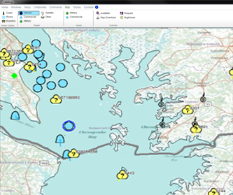
LifeRing features the ability to run in conjunction with SAIL (Surface Aviation Interoperability Laboratory). SAIL data can be displayed within the LifeRing display. The data it receives includes radars, IFF, sonar buoys, AIS, and tactical data links. This data is processed then overlaid on maps and charts from various sources. These data inputs are used to facilitate integration testing of shipboard systems.
The LifeRing SAIL interface is available for Military LifeRing. It requires a Department of State ITAR. Please contact us for more details.
SPOT
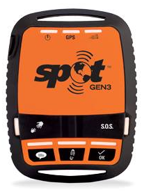
The Spot device is a one way tracking device that uses a satellite signal to relay position data to the SPOT Terminal Headquarters which is ten sent to LifeRing. The SPOT device can send several different message formats including 911, Help, Check OK and Track Progress. LifeRing has the ability to use SPOT devices to track users, deployed without LifeRing.
The LifeRing SPOT interface is available for Commercial LifeRing.
Vectronix PLRF25C
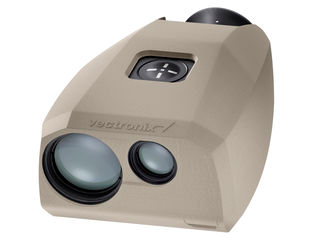
LifeRing uses the PLRF25C Laser Range Finder to automatically locate and place symbols on the LifeRing COP. When LifeRing is connected to AFATDS The LifeRing PCs and Smartphones can send “Call for Fire Commands” to AFATDS.
Available for Military LifeRing Available for Military LifeRing. Requires a Department of State ITAR. Please contact us for more details.
