LifeRing software enables Smartphone, Tablet and PC users to easily and rapidly establish secure ad hoc digital networks that include all within a selected range. Once the AGIS LifeRing Smartphone Icon is selected, LifeRing appears on screen as a map based display. This display provides all on the network with “a sense of where you are”, allowing all users to easily see their present location while enabling them to view the location and status of all other users. Once the visual is in place, LifeRing then provides the means to collaborate, and communicate via PTT, Text Messaging and Voice. The exchange of information occurs in real-time between the participants.
LifeRing works as a scalable C4I Common Operational Picture (COP) System used by Joint Chiefs of Staff J6 and Intelligence Agencies.
LifeRing can be adjusted to display differing types of symbology, different types of maps, different coordinate systems and differing operator controls yet remain compatible with other LifeRing Network Participants. Thus, in a joint Military/First Responder operation, the Military can be using Mil-STD 2525 symbology and Military Grid Reference System with measurements in Kilometers, while First Responders are using a different type of symbology and Latitude / Longitude with measurement in miles. Both can exchange properly geo-referenced data. Furthermore, some of the devices may be displaying in North up while others are displaying in Heading up or operating in either a Portrait or Landscape mode.
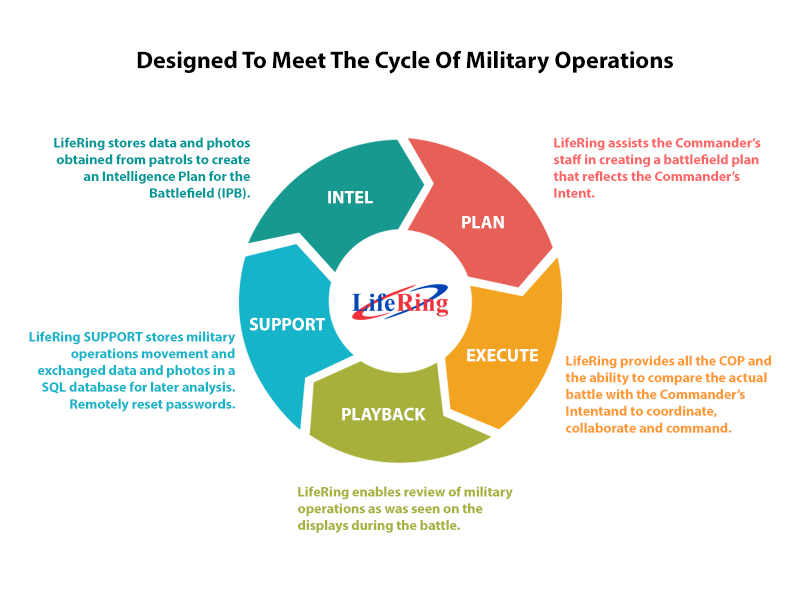
At its core, LifeRing:
- Exchanges location and status information
- Imports and processes Intelligence data
- Imports and processes external data
- Displays the appropriate symbols on a map for Command, Control, Communication and Collaboration
Fully Customizable:
- Capabilities may be added or removed as needed
- A wide variety of maps may be used at any time
- Users may join groups for the sharing of private information
- Custom symbols may be created to represent different locations, people, and events on the map

The LifeRing Server processes over 80 map, Satellite, and Aerial photograph formats. All maps are geo-referenced and can be stitched into other maps. Maps can be loaded into memory, loaded on an SD Card, and obtained from: LifeRing Servers, web map servers, commercial sources and military sources (GeoPDF, NITF, CIB, et al)